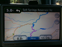
The GPS got me lost.
The destination was Calaveras Big Trees State Park.
Garmin Nuvi took me off the highway.
A winding road led me through burning forest.
I think it was some kind of controlled burn.

The road got rough...
I descended into a ravine...

The GPS kept recalculating.

Whatever...
I crossed a single lane bridge.
I passed over a working flume.
 Flumes direct water over and through the mountains to communities.
I came to a camping area. The road became dirt.
I passed over a fork of the Mokelumne River.
I arrived at the Salt Springs Reservoir.

Several dams dot the Sierra Nevada Mountains.

They capture melting snow-pack.
These dams regulate water flow to farms in the Central Valley.
A nice view of the Mokelumne Valley and PG&E hydroelectric plant.

I decided to back-track to Highway 88.
Salt Springs Reservoir was an unexpected but pleasant detour.
No comments:
Post a Comment